


Add
Description
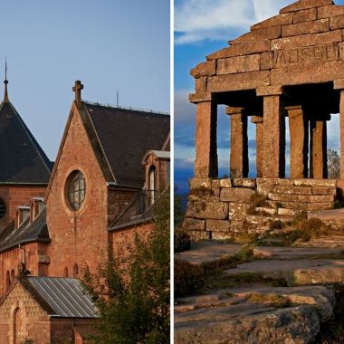
From one ridge to another, this hiking trail will take you from the plain of Alsace to the gates of the plateau Lorrain. From Ottrott, you will discover the tranquility of Mont Sainte-Odile and its breathtaking view of the Rhine plain, before embarking on the conquest of the Champ du Feu (1099 m), the highest point of the Bas-Rhin. The crossing of the Bruche valley will allow you to reach the other side and its summit, the Grand Donon (1009 m), from which you will embrace a panoramic view of Lorraine.
Route realized and proposed in collaboration with the Tourist Office of the Valley of the Bruche.
Possibility to hike in 2 stages with one night in one of the accommodations of the territories (information at the Tourist Offices).
More information
Location
- In the forest
- Mountain
- Panoramic view
Level of difficulty
Expert
Equipment required
Walking shoes
Venue of the event : From Ottrott - Town hall
From Col du Donon - Temple du Donon
From Col du Donon - Temple du Donon
Length of visit/event
2 jours
Nom de la gare la plus proche
5 km - Obernai train station

